| Remote sensing |
 In ecological and epidemiological modeling, survey data are usually collected at
sampling sites and then regionalized in Geographical Information Systems (GIS).
To enhance spatial data densities, continuous field data such as
land surface temperatures (LST), snow coverage, and vegetation indices
are commonly derived from satellite data.
In ecological and epidemiological modeling, survey data are usually collected at
sampling sites and then regionalized in Geographical Information Systems (GIS).
To enhance spatial data densities, continuous field data such as
land surface temperatures (LST), snow coverage, and vegetation indices
are commonly derived from satellite data.
The launches of the new satellite systems Terra (December 1999) and
Aqua (May 2002) significantly improve the situation of data availability
for scientific purposes and predictive epidemiological studies.
The Moderate Resolution Imaging Spectroradiometer (MODIS) is a key instrument
on both Terra and Aqua satellites. As they deliver daily two global coverages
at 250m (Red, NIR), 500m (MIR) and 1000m resolution (TIR), they are most
interesting to support epidemiological studies. Usually one week after
acquisition the data are available to the public.
|
| MODIS sensor (Terra and Aqua satellites) |
|
Related projects: ECODIS (in collaboration with MPBA at FBK, 2001-2004),
EDEN (6th FP of EC, 2004-2009)
The Moderate Resolution Imaging Spectroradiometer (MODIS)
is a 36-channel from visible to thermal-infrared sensor that was launched as part
of the Terra satellite payload in December 1999 and Aqua satellite (May 2002).
The Terra satellite passes twice a day (at about 10:30am, and 22:30pm local time), also
the Aqua satellite passes twice a day (at about 01:30am, and 13:30pm local time).
We are using the following data products to enhance environmental and
epidemiological studies:
References:
- Carpi G., Cagnacci F., Neteler M., Rizzoli A: Tick infestation on roe deer in
relation to geographic and remotely-sensed climatic variables in a tick-borne encephalitis
endemic area. Epidemiology and Infection. In press [ PubMed ]
- A. Rizzoli, M. Neteler, R. Rosà, W. Versini, A. Cristofolini, M. Bregoli,
A. Buckley, E.A. Gould, 2007: Early detection of TBEv spatial distribution
and activity in the Province of Trento assessed using serological and
remotely-sensed climatic data.
Geospatial Health, 1(2):169-176.
[ Abstract |
PDF |
bib ]
- M. Neteler, A. Rizzoli, R. Rosà, 2006: Enhancing spatial disease mapping
through new satellite sensors: tick-borne Encephalitis in Trentino, Italy.
1st OIE International Conference: Use of GIS in Veterinary activities,
Section: Data collection and Remote Sensing applications, 8-11 Oct., Silvi Marina (TE), Italy.
[ Slides PDF ]
- M. Neteler, 2005.
Time series processing of MODIS satellite data for landscape
epidemiological applications.
International Journal of Geoinformatics.
Special Issue on FOSS/GRASS 2004 & GIS-IDEAS 2004, 1(1), pp. 133-138,
March 2005.
[ bib |
Abstract |
PDF ]
- S. Endrizzi, G. Bertoldi, M. Neteler, and R. Rigon, 2005.
Reproduction of snow melting spatial patterns with the hydrologic
model GEOtop. 2nd EGU General Assembly. Poster.
In European Geophysical Union,
Geophysical Research
Abstracts; Vienna, Austria, 24-29 April 2005.
[ bib |
Poster PDF |
Abstract
]
- M. Neteler, 2004.
MODIS time series remote sensing for epidemiological modeling.
In Proc. GeoInformatics for Spatial-Infrastructure Development
in Earth & Allied Sciences: GIS-IDEAS. 2004, Sept. 16-18, Hanoi, Vietnam,
2004.
[ bib |
http |
PDF ]
|
See also: Collection 5 Land Reprocessing Plan and MODIS Land Collection 5 Changes.
|
| ASTER sensor (Terra satellite) |
|
The Advanced Spaceborne Thermal Emission and Reflection Radiometer (ASTER)
is a 14-channel visible to thermal-infrared sensor that was launched as part
of the Earth Observing System (EOS) Terra payload on 18 December 1999.
ASTER is an on-demand instrument which unfortunately limits its usability
for long term studies:
|
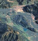
| LANDSAT-TM5 and LANDSAT-TM 7 ETM+ |
|
Related project: WebValley 2004
The LANDSAT Project is a joint initiative of the U.S. Geological Survey
(USGS) and the National Aeronautics and Space Administration (NASA) to
gather Earth resource data using a series of satellites. LANDSAT-TM 7 was
launched in 1999:
|
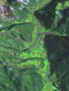
| SRTM data |
|
Related project: WebValley 2004
After waiting for some years (the mission was flown in 2/2000), the
SRTM shuttle elevation data sets were made available for the entire globe
(around 90m resolution, 0:00:03 deg). After postprocessing these data
can be integrated into GIS projects when local high resolution
elevation models are lacking:
|
| SPOT-VGT data |
|
Related project: EDEN (Emerging Diseases in a changing European eNvironment) (IP/FP6)
|
| ICESat data |
|
ICESat (Ice, Cloud,and land Elevation Satellite) is the satellite mission
for measuring ice sheet mass balance, cloud and aerosol heights, as well
as land topography and vegetation characteristics.
|
| Envisat data |
|
In March 2002, the European Space Agency (ESA) launched Envisat, an
advanced polar-orbiting Earth observation satellite which provides
measurements of the atmosphere, ocean, land, and ice.
|
| Developed/Used Software |
|
One of our mission is to support, enhance and distribute Free Software GIS.
In fact, we are exclusively using Free Software/Open Source in our projects as
it fits into our vision of transparent research. While hosting and co-developing
one of the largest Free Software GIS projects, GRASS, we certainly make use
of other related tools to enhance our spatial data toolbox.
Here some related links:
Data access:
Further links:
Markus Neteler 2002 - 2008
Back to HOME page
|
|